geotrack explorer PLUS

GPS/GNSS guidance system for tractors with the accuracy up to 2.5 cm from pass-to-pass. Online planning and agricultural work control.


*When using RTK corrections or a base station

tractor gps, geotrack explorer PLUS, agricultural guidance system, parallel driving system, tractor navigation, agripilot

GPS/GNSS Assistant for Agriculture

A simple tool for seeding, applying plant protection, fertilizing and spraying. Improved features of the system and great opportunities for your business growth and cost saving.

Economy

Forget about using foam markers and wasting your time. GeoTrack is designed to work with wide-cut implements.

Simplicity

Easily understandable menu, convenient settings. Set operating width and press start. From now on, GeoTrack Explorer is ready to work.

Convenience

The set includes all the necessary installation hardware for quick installation of the system. Antenna is attached with a strong magnetic mount.

Online control

Online synchronization of fields and works with your personal account in Agroprofile system. Remote performance control from any part of the world.

Devices Connection

Connecting of peripherals: automatic boom section control of the sprayer, auto-guided steering system and other sensors.

Analytics

History of fields cultivation within the seasons, as well as work planning and performance on multiple devices. Performance statistics.


NEW Explorer
Latest technologies

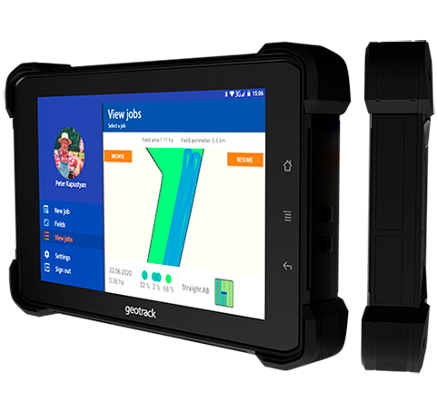
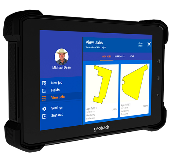
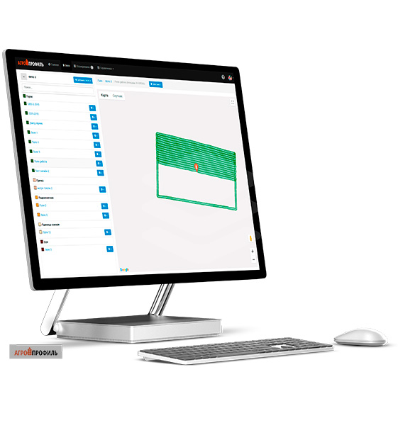
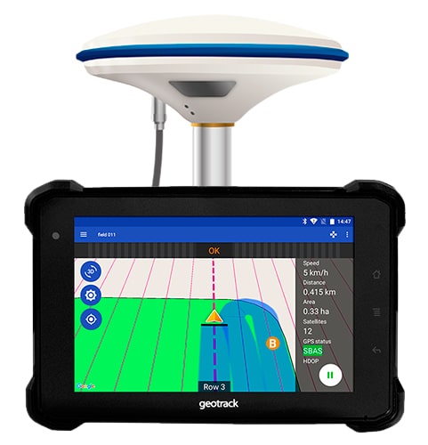
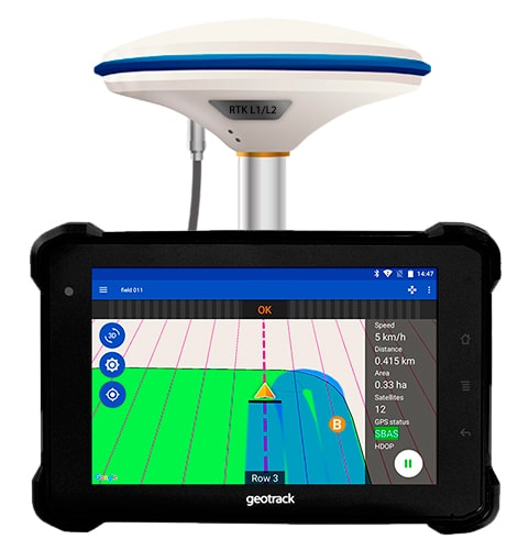
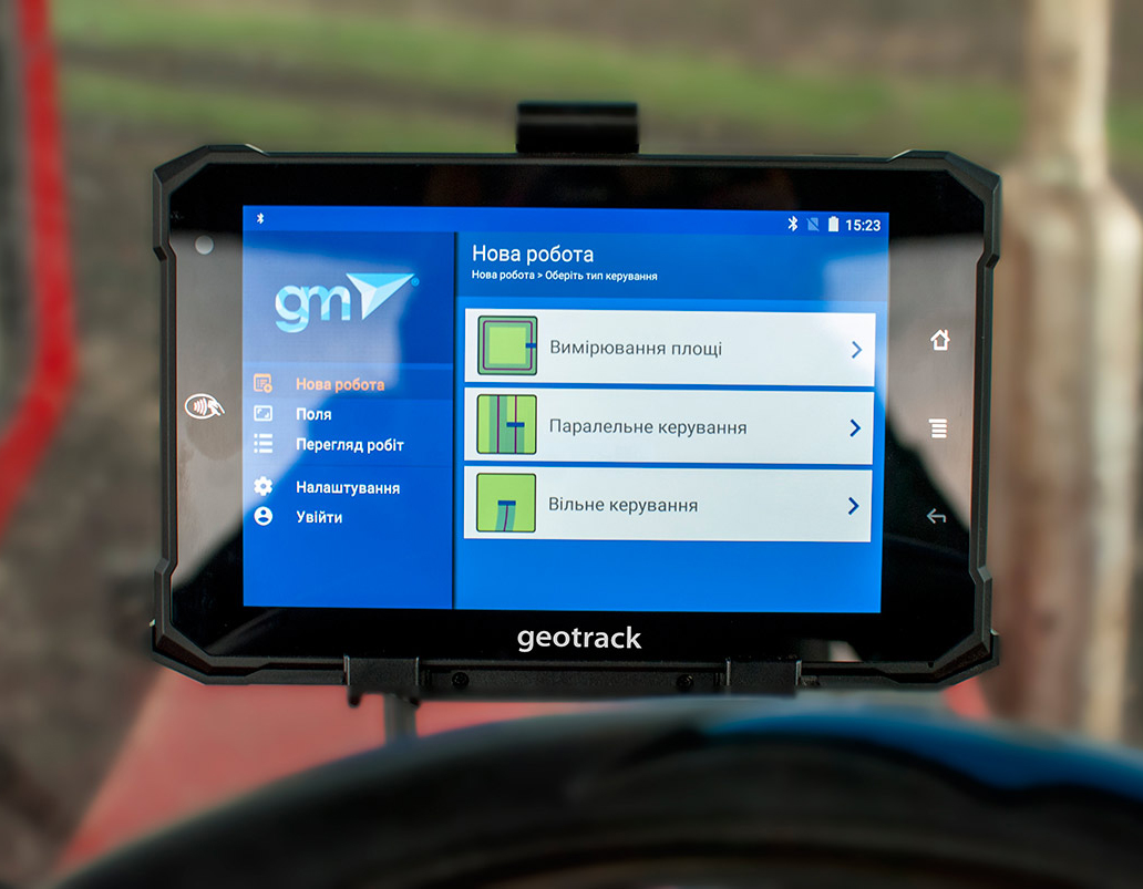
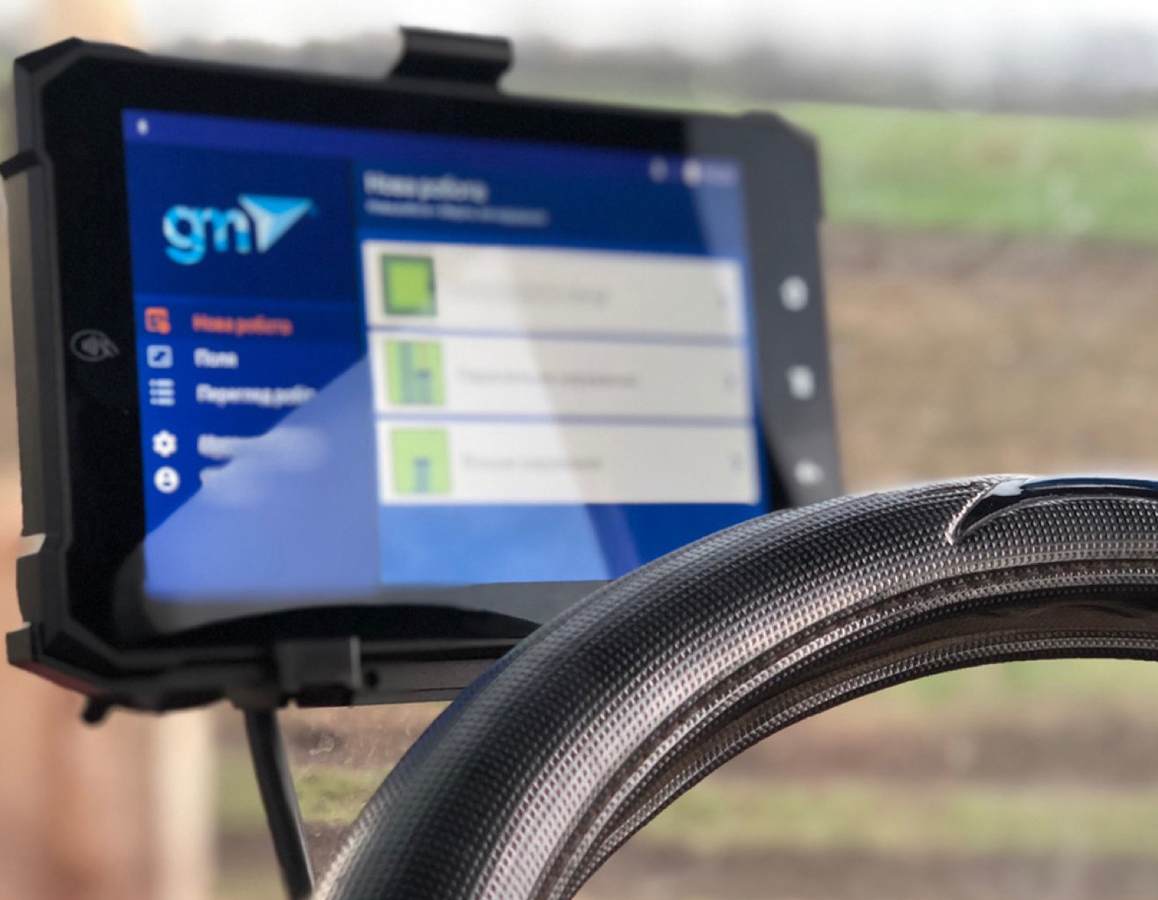
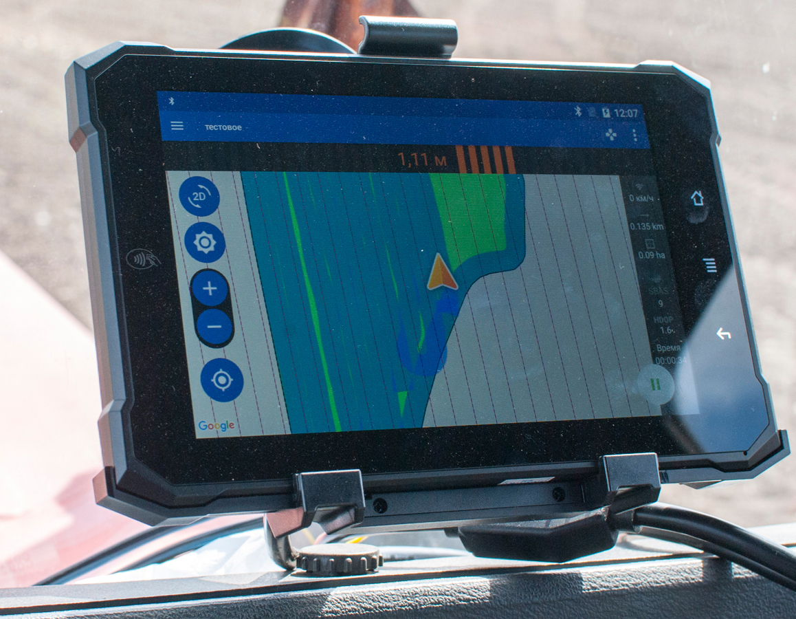
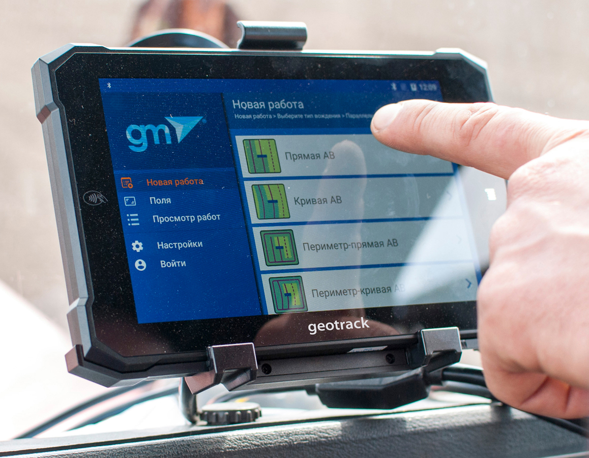
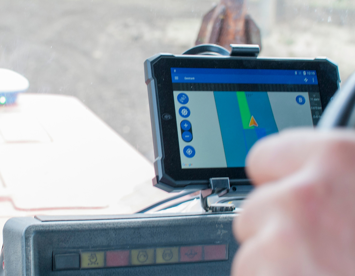
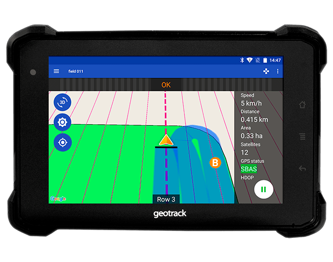
Completely new geotrack agricultural navigator and software that provide unique labour-saving opportunities. High-tech tool for performing daily field work. Updated intuitive menu that greatly facilitates working with device. Unlimited possibilities thanks to the built-in Android operating system. Use GeoMeter branded applications or supplement the functionality of the system with any of the hundreds of thousands of applications on Google Play.

tractor gps, Reliable guidance system geotrack explorer PLUS, parallel guidance system, area measurement, farm management system, agroprofile

Reliable
Functional

GeoTrack Explorer PLUS parallel driving system was built on a shock-resistant and fully sealed industrial field computer with a diagonal of 7 inches (17.8 cm). The set includes a reliable vibration-resistant mount and a docking station for maximum comfort. Available RS-232 connectors for connecting peripherals, such as auto-guided steering system and automatic boom section control module. Information is displayed on a particularly bright screen, which is perfectly readable even on a bright sunny day. High resolution of the screen allows to see a clearer picture. Night mode convenient for vision is provided.

New Explorer
Your assistant

Discover the huge potential with the capabilities of www.agroprofile.com online platform. GeoTrack Explorer PLUS is your personalized device. Log in to the www.agroprofile.com cloud system by your user account and get secure access to your fields and seasonal work plans. Plan the work and control its progress on any of your devices. Assign stages of work and watch their performance online. Tracks of completed works are saved in the system and are available in the history of field cultivation forever. Automatic synchronization when there is an available Internet network via Wi-Fi or mobile network.

Reliable agricultural guidance system geotrack explorer PLUS, tractor gps, parallel guidance system, area measurement, farm management system, agroprofile

Optimal choice
Favourable price

GeoTrack Explorer PLUS system is the best offer in terms of price and quality. Benefits of using:

  • Accurate measurement of field area
  • 5 parallel driving modes
  • Synchronization of fields and works
  • Displaying works on the map
  • Online control of work from the office
  • Performing work offline (without Internet)

What kind of accuracy do you need?

Accuracy of the parallel driving system depends on the selected satellite signal receiver and its technologies. Accuracy plays a crucial role in agricultural navigation systems.

Optimal accuracy
GM SMART L1

Equipped with the latest GM SMART single-frequency L1 receiver, it provides excellent accuracy on a free satellite signal, and also accepts corrections from GNSS RTK stations. Geotrack parallel driving system with GM SMART receiver provides accuracy at the level of 15-20 cm from pass to pass on a free signal and up to 2.5 cm in RTK mode. To achieve such accuracy on a free signal, no base station or subscription fee is required. Accuracy is ensured thanks to the built-in DP coordinate smoothing filter that was developed for agricultural guidance systems. For extra accuracy works, the receiver switches to RTK mode and provides accuracy up to 2.5 cm. GM SMART GNSS receiver works stably and does not lose signal in places where receivers of other manufacturers cannot cope. High stability of satellite signal reception due to simultaneous operation with GPS, GLONASS, GALILEO, BEIDOU, QZSS, IRNSS.
*Unblocking is available for receiving two-frequency signals L1/L2


Learn more
Geotrack explorer PLUS, parallel driving system, navigation guide system, tractor gps, GPS area calculation, GlIDE
geotrack explorer PLUS, parallel driving system, tractor gps, navigation guide system, gps area calculation

Best accuracy
GM SMART L1/L2

Geotrack parallel driving system with GM SMART L1/L2 dual-frequency GNSS receiver is a professional RTK system that provides centimetre positioning accuracy. Agricultural navigation set with GM SMART L1/L2 receiver is a flexible solution. Work on a free signal with a parallel driving accuracy of 15-20 cm, or connect corrections and work with absolute accuracy at the level of 2.5 cm. GM SMART dual-frequency RTK receiver technology allows you to work with base stations at a distance of 50 km or more. GM SMART L1/L2 GNSS receiver works stably and does not lose signal where receivers from other manufacturers cannot cope. High stability of satellite signal reception due to simultaneous operation with GPS, GLONASS, GALILEO, BEIDOU, QZSS, IRNSS satellite systems.


Learn more

Examples of using Geotrack Explorer

Geotrack Explorer PLUS agricultural navigator is already used by thousands of farmers and agricultural enterprises around the world.

Accuracy

High accuracy of parallel driving is provided

Reliability

Durable and protected display, vibration-resistant mount and antenna

Convenience

Intuitive menu allows you to get started quickly

Simplicity

Quick installation or reinstallation on machinery

Benefit

Improvement of the work quality and additional benefits

Price

High-quality and inexpensive parallel driving system for working in the field

Delivery

The product is in stock. Delivery is carried out by local transport companies. Depending on your city, delivery time takes from 1 to 5 days. For more precise terms, please contact us. You will need no more than 15 minutes to install and start the system.